

San Francisco, a city known for its iconic waterfront and scenic beauty, is now facing a growing environmental crisis. Scientists and urban planners are raising alarms about the increased risk to San Francisco’s coastal areas due to rising sea levels combined with land subsidence — a double threat that could dramatically reshape the city’s coastline.
What Is Causing This Coastal Crisis?
There are two major forces putting San Francisco’s coast in danger:
- Rising Sea Levels: Caused by climate change and melting polar ice, global sea levels have been rising steadily.
- Land Subsidence: Parts of San Francisco are slowly sinking due to natural geological processes and human activities like groundwater pumping and infrastructure pressure.
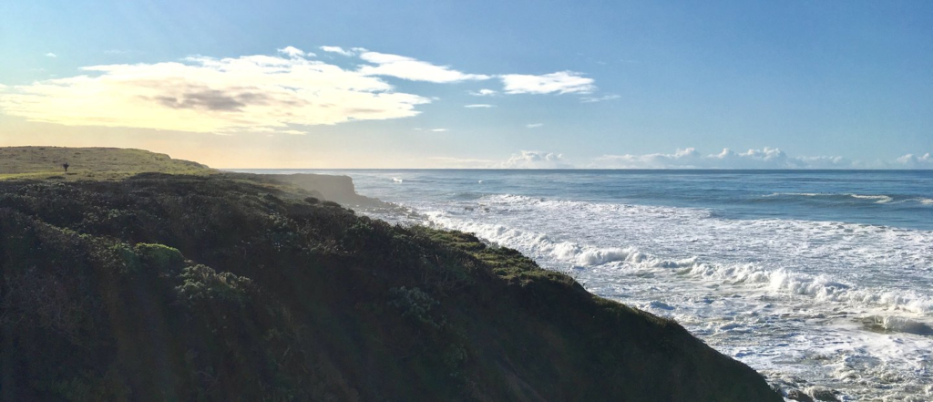
Together, these factors are amplifying the threat. As land sinks and water rises, the effective sea level in many parts of the Bay Area is increasing faster than expected.
According to a recent study by researchers at USGS (U.S. Geological Survey), parts of San Francisco Bay could see sea-level rise of up to 7 feet by the year 2100, especially in areas where the ground is sinking more rapidly.
Key Coastal Areas Under Immediate Threat
Several well-known locations in San Francisco are now under serious threat due to this environmental change:
- Mission Bay: Built on old marshland, this neighborhood is one of the fastest-sinking areas.
- San Francisco International Airport (SFO): A critical infrastructure hub that sits just a few feet above current sea level.
- Treasure Island: An artificial island already showing signs of water encroachment.
- Bayview-Hunters Point: A vulnerable community where environmental and social risks intersect.
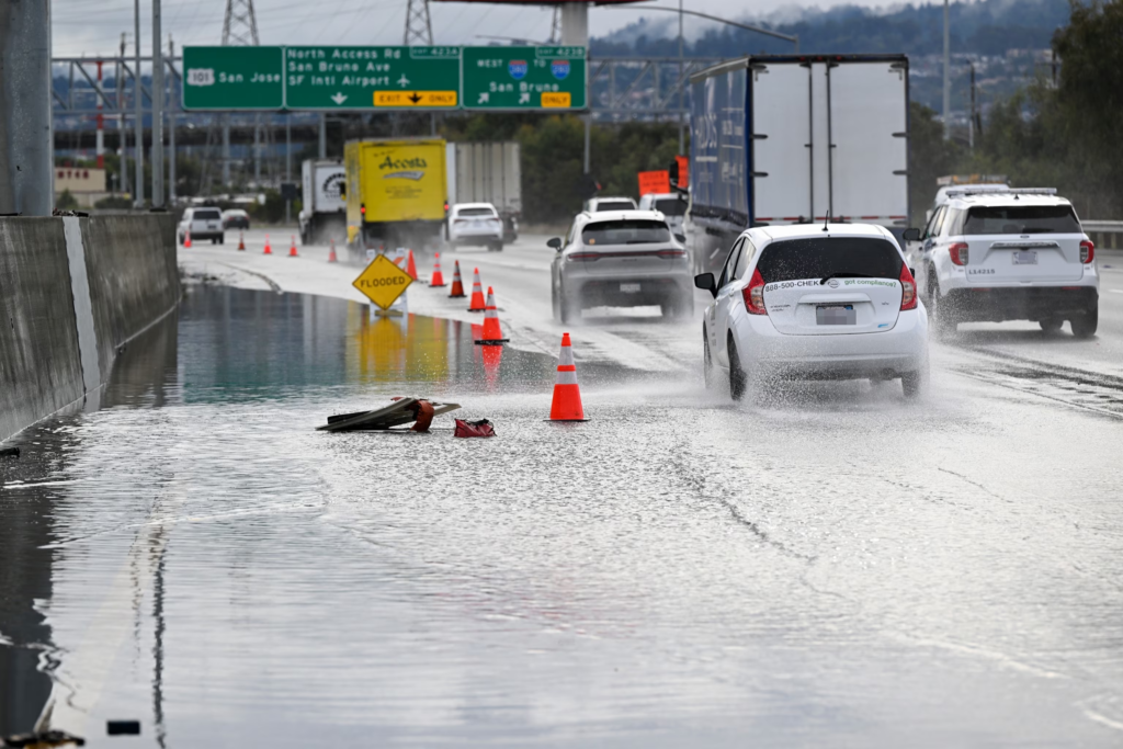
These areas could face frequent flooding, damage to infrastructure, and eventual displacement of residents if no action is taken soon.
The Science Behind Land Subsidence in San Francisco
Land subsidence is not new to San Francisco, but its impact is now accelerating due to both natural factors and human development.
Much of the city was built on filled-in marshlands, especially in neighborhoods like SoMa (South of Market), Mission Bay, and Bayview. These manmade soils are highly compressible, and over time, they sink under the weight of buildings and urban infrastructure.
Add to this the pumping of groundwater in previous decades, and you have the perfect conditions for land to slowly but steadily drop. The result is that even a small increase in sea level can now cause major flooding in areas where the land has sunk.
According to experts from California Climate Science Alliance, subsidence could add another 3–6 inches of relative sea level rise by 2050 in the worst-affected parts of the Bay Area.
What This Means for People Living on the Coast
For residents living near the coastline, the impacts of rising seas and land sinking are already being felt. Many are experiencing:
- Flooded streets during high tides
- Overflowing storm drains during rainstorms
- Water damage to homes and buildings
- Rising insurance costs
In some neighborhoods, property values are already being affected. Real estate experts warn that homes in flood-prone areas may lose value as climate threats become more visible and frequent.
City Leaders and Scientists Seek Urgent Solutions
To fight back against this twin threat, San Francisco city officials and environmental groups are now working together on several fronts:
- Building Sea Walls and Barriers: Plans are underway to reinforce or build new sea walls along key parts of the coast.
- Restoring Wetlands: Wetlands help absorb floodwaters naturally and reduce storm impacts.
- Urban Planning Updates: New building codes are being proposed for coastal construction to factor in sea level rise and subsidence.
- Community Resilience Plans: Education, evacuation drills, and emergency funding are being discussed to protect at-risk communities.
According to the San Francisco Planning Department, more than $5 billion may be needed over the next few decades to protect the city from sea-level rise and related threats.
A Wake-Up Call for Coastal Cities Around the World
What’s happening in San Francisco is not unique. Coastal cities across the globe, from Miami to Jakarta, are also facing similar challenges. However, San Francisco’s unique geology, historical land use, and economic importance make it a crucial case study for climate adaptation.
The city is now working with international partners to share strategies and data to better plan for the future.
What Can Residents Do Now?
While large-scale changes take time, individuals and communities can take action to prepare:
- Stay informed about flood zones and weather alerts
- Consider home elevation or retrofitting in flood-prone areas
- Support climate policies that address coastal protection
- Conserve water and energy to reduce your carbon footprint
Residents can check if their property is in a high-risk area using tools from the FEMA Flood Map Service Center.
Conclusion: A City at the Crossroads
San Francisco’s battle against rising sea levels and land subsidence is more than a local issue — it is a warning for all urban coastal communities.
The choices made now will determine whether future generations can continue to enjoy the city’s iconic waterfront or whether parts of it will be lost to the sea.
As experts continue to study the risks and city leaders develop responses, one thing is clear: time is running out, and action is needed now.
Also Read – Dallas Sinking Fast: The Hidden Danger Lurking Underground