

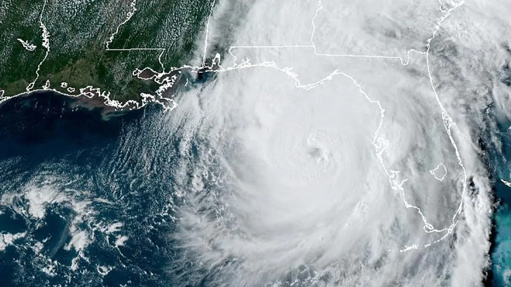
As hurricane season intensifies, a surprising decision by the U.S. Department of Defense has drawn concern from scientists, weather agencies, and emergency response teams across the globe. The Pentagon stops satellite weather data sharing with international partners and civilian meteorologists, prompting widespread worry over how this move could impact hurricane forecasting and public safety.
This sudden shift comes at a time when accurate and timely weather information is more critical than ever. With tropical storms forming more frequently and intensifying faster due to climate change, reliable satellite data is essential for predicting where hurricanes will hit and how severe they might become. So, why did the Pentagon make this move, and what does it mean for the rest of us?
Why the Pentagon Stopped Sharing Satellite Weather Data
For decades, satellite weather data from U.S. military systems like the Defense Meteorological Satellite Program (DMSP) has been a vital resource for global weather forecasting. These satellites provide high-resolution images, temperature readings, cloud cover analysis, and wind data over the oceans — areas often unreachable by ground-based stations.
However, in May 2025, the Pentagon quietly confirmed that it had limited access to some of its key weather satellite feeds for non-military users. While they cited “national security concerns” and the need to “review data sharing policies,” the move effectively halted real-time access to crucial atmospheric data for meteorological services worldwide.
The Impact on Hurricane Forecasting
1. Global Forecasting Models Take a Hit
Many international forecasting centers — including the European Centre for Medium-Range Weather Forecasts (ECMWF), the UK Met Office, and even NOAA — rely on Pentagon-provided satellite data to update and refine their storm prediction models. With this data stream shut off, their models may become less accurate, especially over oceans where civilian satellite coverage is limited.
2. Delays in Early Warnings
Hurricanes can shift paths unexpectedly. Without timely satellite data, early warning systems might struggle to give people and governments enough notice to evacuate or prepare. Even a delay of a few hours in issuing a hurricane warning could put lives and property at greater risk.
3. Loss of Coverage Over Key Regions
Military satellites often cover remote and strategic ocean regions not prioritized by civilian agencies. Losing that data means major “blind spots” in our global weather surveillance, particularly in the Atlantic and Pacific basins — both known breeding grounds for hurricanes.
The Reason Behind the Pentagon’s Decision
So, what drove this decision? While the Department of Defense hasn’t released a full explanation, several factors likely played a role:
- Cybersecurity Risks: Concerns that hostile nations might exploit open data streams to interfere with satellite operations or extract classified information.
- Geopolitical Tensions: As global tensions rise, especially with countries like China and Russia, the Pentagon may be reconsidering how much strategic data it shares — even indirectly.
- Upgrading to New Systems: The U.S. military is in the process of transitioning from older DMSP satellites to newer systems like the Weather System Follow-on – Microwave (WSF-M). During this transition, data might be temporarily restricted.
While these reasons may be valid from a defense standpoint, the broader implications are serious.
Outcry from Scientists and Meteorologists
The reaction from the scientific community has been swift and vocal. Organizations like the American Meteorological Society (AMS) and the World Meteorological Organization (WMO) have called on the Pentagon to reconsider, warning that the decision undermines global weather resilience.
“We’re in an era of extreme weather. Data sharing is not just a courtesy — it’s a necessity,” said Dr. Alan Ward, a climate systems researcher at MIT.
Even NOAA, the U.S.’s own civilian weather agency, has reportedly been affected. While it maintains its own satellites, it often supplements them with military data to improve accuracy.
What This Means for the Public
For the average person living in hurricane-prone regions — from the Gulf Coast of the U.S. to the Caribbean, South Asia, and the Pacific islands — the effects of this decision may not be immediately obvious. But over time, you may notice:
- Less Accurate Storm Track Predictions
- Shorter Warning Times Before Storms Make Landfall
- Higher Risk of Surprise Flooding or Wind Damage
Local governments, already under pressure to deal with climate-related disasters, may also face increased strain without reliable forecasts to guide emergency planning.
Can Civilian Satellites Fill the Gap?
Agencies like NASA, NOAA, and EUMETSAT in Europe operate their own weather satellites, and private companies like Spire Global and Planet Labs are stepping in with commercial options. However, they may not have the same coverage or capabilities as the military’s systems — at least not yet.
Private data often comes at a cost, limiting access for underfunded agencies in developing countries. Plus, launching and maintaining satellites is expensive and time-consuming, making it unlikely that civilians can fully replace what the Pentagon offers anytime soon.
The Bigger Picture: Weather Data and National Security
This decision highlights a larger conversation: Should weather data be considered a public good or a national security asset?
Historically, weather data has been one of the few areas where global cooperation prevailed, even during the Cold War. Shared satellite data helped nations prepare for disasters, save lives, and coordinate humanitarian responses. The Pentagon’s move disrupts that tradition and raises the question: If one nation pulls back, will others follow?
Calls for Transparency and Policy Review
Several lawmakers and advocacy groups are now pushing for Congress to investigate the decision. Some have proposed legislation that would:
- Mandate minimum public access to non-sensitive military satellite data.
- Increase funding for NOAA to develop more independent capabilities.
- Promote international agreements around weather data sharing.
“Storms don’t recognize borders. Neither should the data we use to prepare for them,” said Senator Rachel O’Connor, a member of the Senate Committee on Commerce, Science, and Transportation.
What’s Next?
As of now, the Pentagon has not committed to a timeline for restoring access or releasing more details. Meanwhile, the Atlantic hurricane season is entering its peak months, with meteorologists predicting a higher-than-average number of storms due to warmer ocean temperatures.
Until more clarity is provided, global weather agencies will have to make do with limited data — and the public will have to hope that forecasting tools remain strong enough to prevent disasters.
Conclusion: A Dangerous Precedent?
The Pentagon’s decision to stop sharing satellite weather data during hurricane season has created more questions than answers. While national security is important, so is public safety and in many cases, the two go hand in hand.
With extreme weather events becoming more common, now is not the time to limit the tools we use to fight them. International cooperation, open access to weather data, and strong forecasting systems must remain a priority for the sake of every person who lives in a storm’s path.
Read Next – Senate Votes on Trump Tax Cuts and Medicaid Bill Amid Border Security Debate