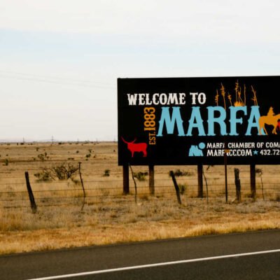

The Pony Express Trail Nevada segment is one of the most fascinating parts of the famous Pony Express National Historic Trail. Stretching through wide desert valleys and rugged mountain passes, this route once carried the hopes and messages of a young, fast-growing United States. Today, this historic trail invites modern explorers, history buffs, and road trippers to travel back in time, following in the hoofbeats of some of America’s bravest riders.
What is the Pony Express Trail?
The Pony Express Trail was a fast mail service that operated between April 1860 and October 1861. It connected Missouri to California with riders on horseback covering nearly 1,900 miles in just 10 days. Riders changed horses at stations placed every 10 to 15 miles. Though it lasted only 18 months, the Pony Express became a symbol of the American West — showcasing courage, speed, and innovation during a time of rapid expansion.
The Nevada segment of this trail played a crucial role in the relay, as it covered some of the most remote and difficult terrains. From deserts to mountain ranges, the route through Nevada tested the endurance of both horses and riders.
The Importance of the Nevada Segment
A Key Middle Section
Nevada was right in the middle of the Pony Express route. Riders had already crossed the Great Plains and the Rocky Mountains by the time they reached Nevada. But what awaited them here was no less challenging — vast stretches of arid land, extreme temperatures, and isolated stations.
Why It Still Matters Today
Many of the original Pony Express stations and trail markers can still be found across Nevada. The trail offers a look into early American communication and westward expansion. It’s also a reminder of how far we’ve come — from horseback mail delivery to instant digital messages.
Top Sites Along the Pony Express Trail Nevada Segment
If you’re planning a road trip or simply want to explore the history of the Pony Express, these key Nevada locations are worth a visit.
1. Fort Churchill State Historic Park
Located near Silver Springs, Fort Churchill was built in 1860 to protect Pony Express riders and settlers. Today, you can walk through the adobe ruins of this once-bustling military fort and learn about its connection to the trail.
Highlights:
- Visitor center with Pony Express exhibits
- Well-preserved ruins of 19th-century military buildings
- Nearby camping and picnic areas
2. Sand Springs Station
Just off Highway 50, the Sand Springs Station is one of the few remaining station ruins. It’s located near Sand Mountain Recreation Area, so you can enjoy some desert adventure while visiting a piece of history.
Highlights:
- Marked trail to the station ruins
- Informational plaques
- Close to off-road trails and sand dunes
3. Cold Springs Station Ruins
These ruins lie between Austin and Fallon and give visitors a sense of how isolated life on the trail really was. This stone structure was once a vital rest stop for riders traveling through Nevada’s high desert.
Highlights:
- Interpretive signs explaining the site’s role
- Remote, peaceful setting
- Access to nearby Cold Springs rest area
4. Austin and the Toiyabe Range
The town of Austin, a mining town founded during the silver boom, is located near several parts of the old trail. The surrounding Toiyabe Range offers amazing views and hiking opportunities.
Highlights:
- Pony Canyon Trailhead
- Local museums and historic buildings
- Scenic Highway 50, also known as the “Loneliest Road in America”
How to Travel the Trail Today
You can experience the Pony Express Trail Nevada segment by car, bike, or even on foot for shorter hikes. While most of the original trail is now remote and not fully paved, large portions are accessible via state highways and backcountry roads.
Route Overview
- Entry from the East: Coming from Utah, the trail enters Nevada near Schellbourne Pass.
- Main Stops: Ely → Eureka → Austin → Fallon → Fort Churchill → Lake Tahoe
- Exit to California: Cross into California at the Sierra Nevada mountains.
Travel Tips
- Bring a Map: Cell service is spotty in many areas. Grab a printed trail guide or use an offline GPS.
- Prepare for the Elements: Nevada’s desert can be extremely hot in the summer and freezing in the winter.
- Check for Road Conditions: Some parts of the trail are dirt roads and can become muddy or impassable after rain.
Wildlife and Natural Beauty Along the Trail
The Nevada portion of the Pony Express Trail isn’t just about history — it also offers stunning natural landscapes.
Desert Valleys and Salt Flats
Travelers will pass through long stretches of sagebrush desert and shimmering salt flats. It’s easy to imagine the dust and heat that early riders had to face.
Mountain Passes
Rugged ranges like the Schell Creek and Toiyabe Mountains offer striking views, especially at sunrise and sunset. You might even spot wild horses or mule deer.
Night Skies
Since much of the trail crosses undeveloped land, it’s perfect for stargazing. Bring a telescope or simply lie back and enjoy one of the darkest skies in the U.S.
Preserving History: Trail Markers and Educational Efforts
Thanks to efforts by the National Park Service and local heritage groups, much of the Pony Express Trail Nevada segment has been preserved.
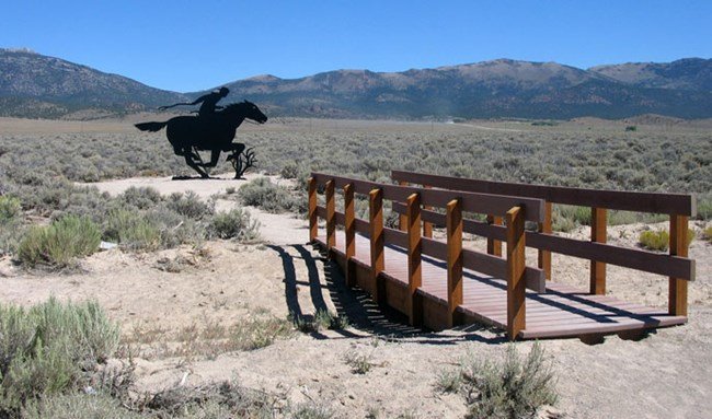
Trail Markers
Across the state, you’ll find brown trail signs with the Pony Express logo. These mark original or nearby routes. Some areas also feature interpretive signs with historical background.
National Historic Trail Designation
The Pony Express Trail is one of 19 National Historic Trails in the U.S., and the Nevada portion is considered critical due to its length and well-preserved sites.
Interactive Resources
The National Park Service website provides interactive maps, station histories, and downloadable guides. It’s a great place to start if you’re planning a deeper exploration.
Interesting Facts About the Pony Express Trail Nevada Segment
- Longest Dry Stretch: Nevada included some of the driest portions of the entire trail, with riders often traveling 30 to 40 miles between water sources.
- Native American Lands: Many stations were located near tribal lands. Conflicts did occur, especially during the Paiute War of 1860.
- Average Rider Age: Most Pony Express riders were teens, with some as young as 14 years old.
- Speed Over Safety: Riders traveled at an average speed of 10 miles per hour, often galloping through dangerous terrain at night or in storms.
Why the Trail Still Inspires
Though the Pony Express lasted less than two years, it continues to capture the American imagination. It symbolizes courage, progress, and the drive to connect across great distances — values that still resonate today.
Nevada’s section of the Pony Express Trail offers a chance to not just learn about this iconic chapter of history, but to walk or drive through it yourself. Whether you’re chasing adventure, history, or the perfect photo, this trail delivers.
Plan Your Visit
Whether you’re doing the full trail or just visiting a few sites in Nevada, here’s what you’ll need:
Essentials:
- Refillable water bottles
- Sun protection (hat, sunglasses, sunscreen)
- Trail guide or GPS
- Full tank of gas
- Snacks or packed meals
Recommended Add-Ons:
- Camera or drone
- Historical guidebook
- Journal for notes or sketches
- National Park Passport for stamp collection
Final Thoughts
The Pony Express Trail Nevada segment is more than just an old route — it’s a living piece of American history. Its lonely roads, dramatic views, and stories of daring riders offer something for everyone. Whether you’re a history buff, road tripper, or weekend explorer, traveling this trail is a rewarding and unforgettable journey through the heart of the American West.
Do Follow USA Glory On Instagram
Read Next – The Tenement Museum: A Powerful Glimpse Into NYC’s Past