

USA And India 3D Earth Mission is about to change how we look at the planet. The two countries have teamed up for a groundbreaking satellite project that will scan Earth in three dimensions like never before. This joint space mission between NASA and ISRO (Indian Space Research Organisation) marks a powerful moment in international cooperation, cutting-edge science, and environmental monitoring.
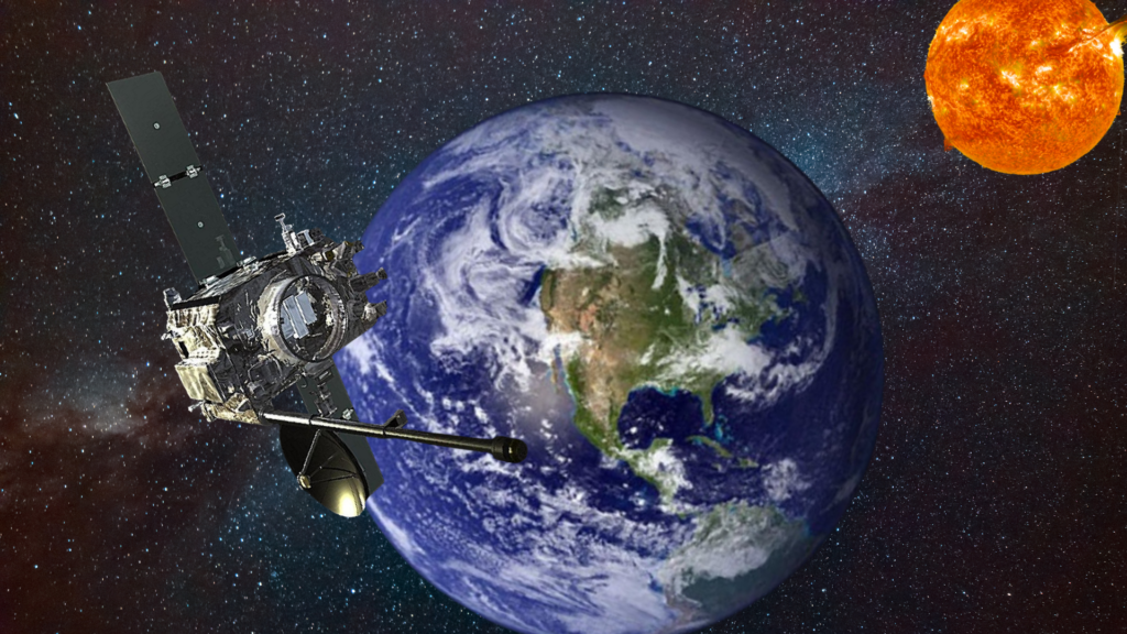
This mission, officially called the NASA-ISRO Synthetic Aperture Radar (NISAR), is the first satellite of its kind developed jointly by the United States and India. It will launch from the Satish Dhawan Space Centre in India and circle the Earth nearly 14 times a day. With the ability to capture detailed images in all weather conditions, the mission aims to provide critical data on climate change, natural disasters, and much more.
Here are the 7 most important things you need to know about this historic effort.
1. USA and India Collaborate for Global Good
This mission is a first-of-its-kind collaboration between two of the world’s largest space agencies. NASA and ISRO are combining their technology and knowledge to build a powerful Earth-observing satellite that benefits not just their countries but the entire world.
The partnership sends a clear message global cooperation in science can lead to amazing outcomes. With rising climate threats and natural disasters affecting every continent, the USA and India are stepping up together.

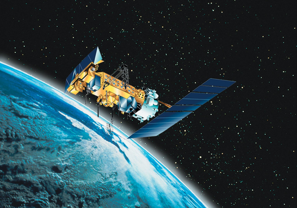
2. The NISAR Satellite Will Scan Earth in 3D
At the heart of the mission is a high-tech satellite called NISAR. This spacecraft is designed to scan Earth using dual-frequency radar, giving it the unique ability to capture 3D images of Earth’s surface in unprecedented detail. It can monitor things like ground movement, melting glaciers, forest changes, and earthquakes with high precision.
Unlike regular satellites that rely on light or optical imaging, NISAR’s radar can “see” through clouds and even at night. That makes it an extremely reliable tool for real-time environmental monitoring.
3. Real-Time Climate and Disaster Data
One of the most important features of the USA And India 3D Earth Mission is its ability to help us understand climate change. The satellite will collect data on land and ice changes, vegetation loss, and soil moisture levels.
In addition, it can monitor natural disasters like floods, landslides, and earthquakes often as they happen. This real-time data can be shared with governments and emergency teams to help save lives and reduce damage.
For countries in vulnerable regions like South Asia, the Pacific Islands, and parts of Africa, this could be a game changer.
4. A Giant Step for India’s Space Industry
For India, this mission shows how far its space program has come. ISRO has already made headlines with its lunar missions and low-cost satellite launches. Now, with NISAR, it enters the global stage for environmental science and Earth observation.
The satellite will launch aboard India’s trusted GSLV rocket, and Indian engineers were responsible for building major parts of the mission, including the satellite’s bus (structure and power systems). This places India as a serious player in future Earth and space science missions.
5. How Will NISAR Help Everyday People?
While the mission sounds highly technical, its benefits are for everyone. Farmers can use the data to track crop health and soil conditions. City planners can use it to prevent building in areas at risk of landslides or flooding. Environmentalists can track illegal deforestation or glacier melting in the Himalayas.
With its ability to track even the smallest shifts in Earth’s crust, it might even help predict future earthquakes.
In a world where climate data can shape policy, agriculture, disaster response, and conservation, this satellite could be one of the most useful tools ever launched.
6. Timeline and Launch Details
The NISAR satellite is set to launch in early 2025 from the Satish Dhawan Space Centre in Sriharikota, India. Once in orbit, it will travel at a speed of about 7.5 kilometers per second and scan the Earth every 12 days.
The mission is expected to last at least three years, during which it will collect and transmit thousands of terabytes of valuable scientific data to ground stations in both India and USA.
7. A Symbol of Hope in a Divided World
In a time when the world is facing many global challenges from geopolitical conflicts to natural disasters the USA and India 3D Earth Mission is a powerful example of peaceful, productive collaboration.
It also reflects a broader shift toward “science diplomacy,” where countries work together on shared goals like sustainability, climate protection, and technological progress.
As space becomes a bigger part of our daily lives, missions like this show what’s possible when nations invest in solutions together.
Final Thoughts
The USA And India 3D Earth Mission is more than a satellite launch it’s a milestone in international cooperation, environmental science, and future planning. From tracking melting glaciers to helping communities prepare for disasters, this mission will benefit generations to come.
It’s a proud moment for both NASA and ISRO, and for the millions of people whose lives may be made safer, smarter, and more sustainable because of this shared vision.
With countries around the world watching, this powerful satellite may inspire new collaborations and perhaps even more joint missions in the near future.
Read more – Critical warning: U.S. IT leadership at risk amid funding gaps